
Walking a Sacramento County Street Directory
A useful street directory search moves in a fixed order. First make the address exact, then let the county map supply the parcel identifier. The APN is more stable than a street label because it ties the parcel map to assessment fields and the Recorder reference. Ownership is a public-record question. Occupancy is a separate inference that needs care.
For a Sacramento County street, the working chain is address to parcel, parcel to owner and mailing fields, owner to recorded document, and address to historical directory. Voter information is not an open street browse tool, so it belongs later and only through an authorized channel.
- Run the exact situs address through the Sacramento County Assessor Parcel Viewer and save the APN, value, land-use code, and map reference.
- Pan along the same street in the parcel map and click each adjoining parcel rather than assuming house numbers form a perfect sequence.
- Use the Assessor lobby or a public-record request for the secured owner, mailing address, exemptions, and Recorder book or page.
- Search the Recorder index with current and earlier party-name variants, then order or inspect the deed image.
- Use the Elections office only through the approved voter-file process, and use a Sacramento Room reverse directory for older listed occupants.
Turn a Sacramento Address Into an APN
The Assessor viewer starts with either an address or an assessor parcel number. Address autocomplete handles the situs location, while the APN route is useful when a deed, tax notice, or prior record already supplies the county key. The map can pan and zoom, identify a parcel, and show assessment context. It is not a title search and its parcel lines are not a legal survey.
| Address | Text or autocomplete route for the situs or property address; unit handling may vary. |
|---|---|
| APN | Assessor parcel number; keep the punctuation format returned by the county. |
| Map pan and zoom | Browse a street segment and inspect nearby parcel shapes. |
| Parcel identify | Click a mapped polygon to open assessment and map attributes. |
| Layers and basemap | Parcel and assessment context; zoning is not the same as the Assessor land-use code. |
The public field inventory is broader than the online map. The Assessor public-records description lists secured owner, situs and mailing addresses, values, exemptions, tax-rate area, zoning or land-use code, Recorder reference, maps, and limited characteristics.
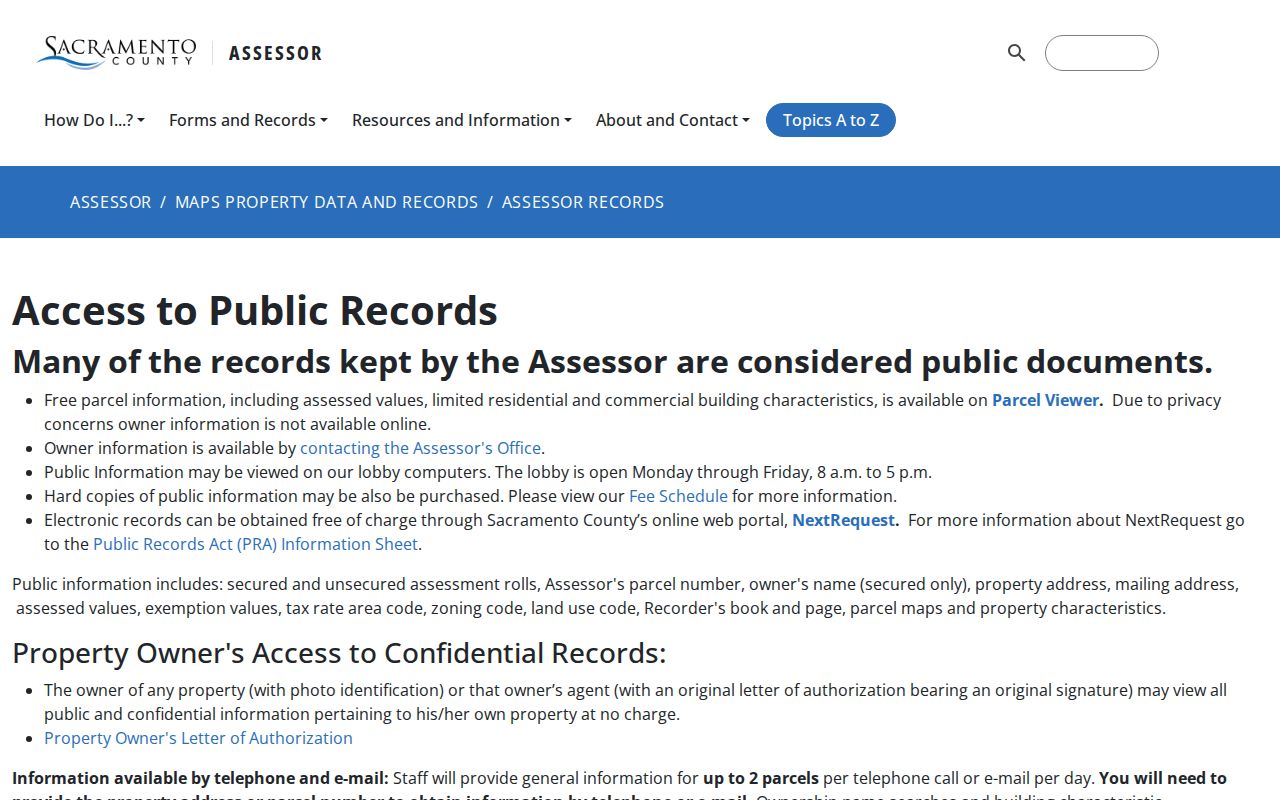
The public-field capture separates what the web viewer shows from what the full roll can supply through a lobby or request. Record the situs and mailing addresses as two different fields.
Browse Sacramento Parcels Along the Block
The interactive Sacramento parcel viewer is the street directory's map layer. Start at one valid address, zoom until parcel boundaries are visible, and click neighboring polygons one by one. Corners, alleys, condominium projects, irregular subdivisions, and parcels that do not line up with house numbers can defeat a simple left-to-right count.
Save each APN before moving to the next parcel. Then compare the geometry with the situs address and land-use context. Before clicking through the next lot, reopen the interactive Sacramento parcel viewer. A map adjacency is strong evidence that lots touch. It is not proof that the people associated with those lots know one another, share a household, or occupy the structure. For a legal boundary, use the deed's legal description and the proper survey or title source.
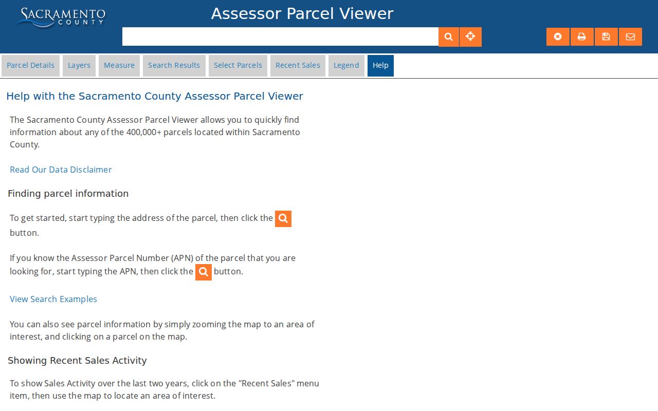
The parcel-map capture shows the browse mode that supports a street-by-street sequence. It gives a way to identify adjacent APNs without turning the map into an unsupported household list.
Read the Assessor parcel-viewer disclaimer and instructions before treating map lines as record evidence.
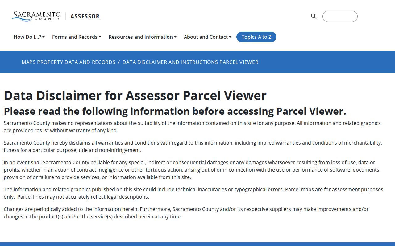
The county disclaimer is a needed part of the map result. Assessment geometry helps find a record, but it does not replace the legal description or a survey.
Sacramento County Records by Address
Several record sets can be walked street by street, but they do not all describe the same person. The Assessor ties a parcel to owner and mailing fields. The Recorder ties named parties to an instrument. A permit ties an address to work, dates, or an applicant. A reverse directory ties an address to a listed subscriber in a particular edition. The table keeps those roles separate.
| Record Set | Keeper | What It Shows | Access |
|---|---|---|---|
| Assessor public fields | Sacramento County Assessor | Owner, mailing and situs, APN, values, exemptions, Recorder reference | Viewer for map context; lobby or request for owner fields |
| Parcel map | Assessor Parcel Viewer | Geometry, parcel sequence, map attributes, limited characteristics | Free web viewer; assessment aid only |
| Deed and lien index | Clerk/Recorder | Parties, type, recording date, book/page or document number | Free index; copy or office inspection for image |
| Permit and code case | City or county custodian | Work history, status, dates, applicant or contractor roles | Jurisdiction portal, counter, or request |
| Reverse directory | Sacramento Room | Edition-specific listed occupant or subscriber by address | Library volume, with year and abbreviation key |
APN is the useful bridge. It can connect the parcel map to Assessor fields and a Recorder reference, while the street name helps locate the historical address-book entry. No row alone supplies a complete list of everyone on the block.
Owner Names Need a Sacramento Records Request
Owner data is deliberately removed from the web viewer, so the next move is not a wider name search. Visit the Assessor lobby, call or email with an address or APN, or submit a focused electronic request through Sacramento County NextRequest. The Assessor says staff can provide at most two parcels per day by phone or email. The lobby computers are available at 3636 American River Drive, Suite 200, Sacramento, Monday through Friday from 8 a.m. to 5 p.m.
NextRequest is also the route for electronic public records. The county's public-record request instructions support submission, tracking, and review of prior requests. A narrow request should name the parcel or address, record field, and date range. California Public Records Act requests seek identifiable existing records. They do not require an agency to build a new resident list.
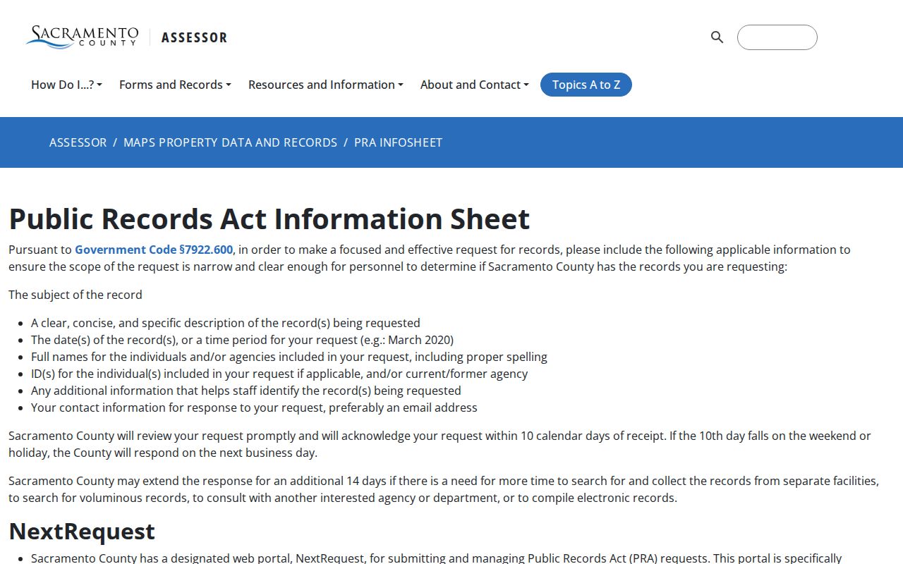
The request-guide capture shows why a street directory search needs a fallback channel. A web omission can be answered by a precise custodian request.
Open Sacramento County NextRequest to submit or track the electronic request tied to the parcel.
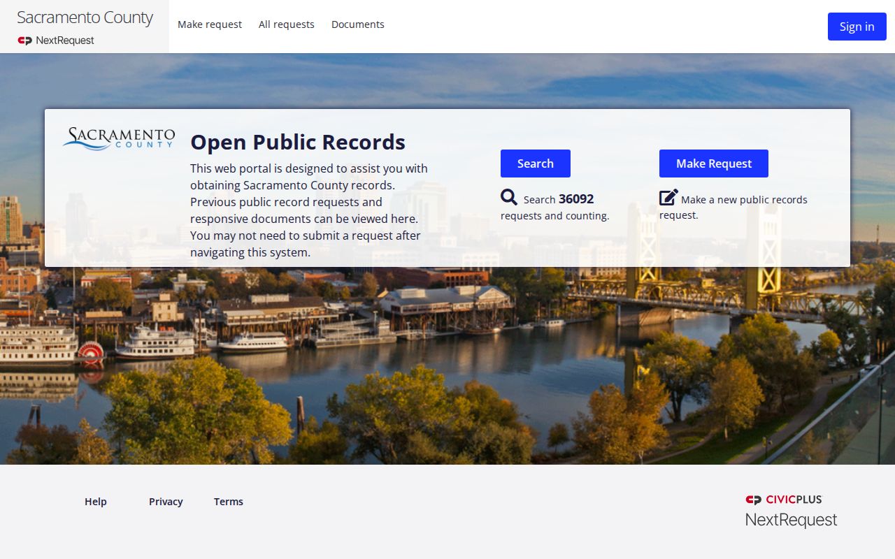
NextRequest supplies submission and tracking rather than an instant owner-name list. Keep the request number with the APN and source date.
Permits Date Sacramento Property Activity
Permit history can explain when a structure changed, but it must not be read as a resident list. Sacramento's public Accela or Citizen Portal generally searches by record or permit number, address, parcel, project, or licensed professional. A result may contain record type, status, applied and issued dates, site address, description, related records, and inspections. The City of Sacramento's early-1900s through 1982 permit cards are in its Online Records Library; 1982 to present permits are in Accela Public Permit Search.
Older plans have limits. No plans survive before 1955, and most surviving plans are on microfilm or digital media. Health and Safety Code sections 19850 through 19853 can require written authorization from the property owner and each licensed professional or successor who signed before plan copies are released, although plans may be viewed. Unincorporated addresses belong with county Building Permits and Inspection. Check jurisdiction before treating a permit result as part of a Sacramento County street history.
Chain a Sacramento Street Parcel Through Deeds
The Recorder index searches parties and recording facts, not a reliable street text trail. Begin with the current owner and Recorder reference from the Assessor. Search the owner as a grantee, then read the deed to find the grantor, recording date, legal description, and prior document references. Search the grantor as an earlier grantee and compare the same parcel, lot, block, subdivision, or APN lineage.
A Sacramento deed chain can reach an unusually early index date because the online index begins in 1849, but the images remain office or copy access. Name variants, trusts, parcel splits, and old legal descriptions can interrupt a straight search. The document image matters because the index label does not replace vesting language or the land description.
- Parcel
- An Assessor-mapped unit used to organize property records.
- Situs address
- The physical location of the property, distinct from the mailing destination.
- Plat
- A recorded map that can help connect lots, blocks, and subdivisions through address changes.
- Criss-cross directory
- A historical address-first directory section that may list an occupant or subscriber.
Criss-Cross Directories Read Sacramento Streets
Modern property records answer an ownership question. A historical reverse or criss-cross directory is the better address-to-listed-occupant tool for an older year. In a Sacramento Room volume, select the edition first, open the street section, find the number, and transcribe the occupant or telephone entry exactly. Then check the alphabetical section for the same surname, spouse notation, occupation, or another address.
Directory conventions change by edition. The letter “r” often means residence, “h” house, and “bds” boards, but the volume's own abbreviation key controls. A telephone book may show only a subscriber. Pair the result with a deed, census, obituary, or permit before describing a listed occupant as an owner. The historical shelf and its catalog gaps are developed in the Sacramento County city directory archive.
Postal Sacramento Is Not Always City Sacramento
A Sacramento mailing city can cover unincorporated territory. ZIP codes 95821, 95825, and 95864 are substantially associated with Arden-Arcade, while 95826 includes Rosemont and 95827 reaches the Rancho Cordova and industrial edge. Similar boundary issues appear around Citrus Heights, Carmichael, Orangevale, Rio Linda, Florin, Vineyard, and Antelope. Postal geography is a delivery system, not a city-limit record.
That distinction changes the custodian. A Sacramento city permit or code case cannot stand in for county building records when the parcel is unincorporated. Check the parcel jurisdiction before requesting a street history. A ZIP can narrow the search, but the APN and legal jurisdiction carry the record chain.
What the Sacramento Street Directory Cannot Show
A street directory cannot promise every household member, a current occupant, or an open list of registered voters. Property ownership is not the same as physical presence. DMV personal data is restricted by the federal Driver's Privacy Protection Act, utility customer data is not a public directory substitute, and California voter data is limited to approved purposes. A protected Safe at Home participant may use a substitute address and confidential voter registration.
Lawful use. Sacramento County address records support personal, lawful research such as family history, estate work, and property curiosity. Never use a street result to stalk, harass, intimidate, threaten, or harm anyone.
When the goal shifts from a full street to one named person, use the Sacramento County resident lookup and a source that can be checked against identity and date. Keep the record identifier, ask the direct custodian about a correction, and treat a missing online field as an access boundary rather than proof that no record exists.